7′ 14 sec at Hilo which rapidly rose since 6pm Saturday nite and is starting to level off…6′ 13 sec for SE Bouy which ramped earlier and shows a slow decline. SNN.
Light to moderate trade winds will continue across the islands under a high-pressure ridge far to the north of the state.
Shower activity for most islands will favor typical windward and mountain areas trending towards the overnight and early morning hours from Sunday into Monday.
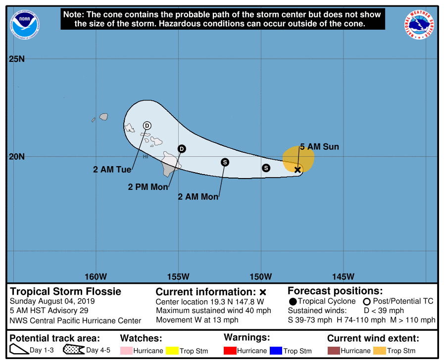
The forecast track for Tropical Cyclone Flossie continues to trend much closer to the Hawaiian Islands with increasing threats for high surf, the potential for flash flooding, strong gusty winds, and thunderstorms.
Drier air returns late Wednesday into Thursday with increasing trade wind speeds as Flossie moves northwest away from the islands.
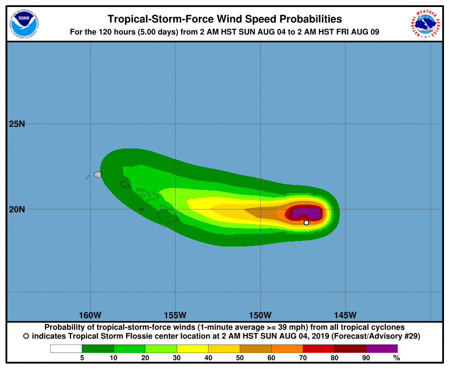
35KT Tropical Storm Flossie Discussion #29 NWS Central Pacific Hurricane Center Honolulu 500 AM HST Sun Aug 4 ]
Strong thunderstorms in Flossie’s eastern semicircle persisted for the first half of the night,
prevented from moving over the low- level circulation center (LLCC) by persistent westerly vertical wind shear near 25 kt.
Those thunderstorms began diminishing shortly after midnight, and while the LLCC remains obscured by mid- and high-level cloudiness,
it appears poised to make an appearance. Subjective and objective Dvorak intensity estimates indicate that Flossie is barely hanging on as a tropical storm,
and with the LLCC becoming increasingly exposed, the initial intensity estimate for this advisory is lowered to 35 kt.
Without any overnight microwave passes to assist with center- finding, the initial motion estimate is primarily based on tracking what can be seen of the LLCC, yielding 280/11 kt. A low- to mid- level ridge north of the cyclone is expected to support a general motion toward the west over the next 24-36 hours, especially as Flossie weakens further and is steered by the low-level trade wind flow. After that, Flossie will round the western portion of the ridge, interact with a persistent deep-layer trough northwest of Hawaii, and dissipate. Given average forecast error, a Tropical Storm Watch may be required for portions of thE Hawaiian Islands later today. The gradual spin-down of Flossie is expected to continue as it draws closer to the Hawaiian Islands… The forecast track takes Flossie into an area of even greater vertical wind shear, leading to steady weakening, soon followed by dissipation.

 ]
]