Clyde Aikau made a good call not to run. Conditions and size don’t meet the standard. Swell still rising to 20′ even some near 25′ outside and Pe’ahi likely to reach near 30′ later. SNN
The 2022 – 2023 Eddie Aikau Big Wave Invitational | Waimea Bay (theeddieaikau.com)
“Due to the direction of the swell and the wind conditions for 11/11/23, we care cancelling The Eddie and going to yellow,” Eddie Aikau’s brother, Clyde, wrote in an Instagram post.
STILL, THIS WILL BE BY FAR THE BIGGEST SWELL THIS SEASON. THE EPISIDE WILL BUILD FAST WEDNESDAY DAWN…WAIMEA COULD SEE SOME 25′ SECOND HALF OF THE DAY AT PEAK BUT MAYBE SKETCHY WIND CONDITIONS. SNN
CHECK THE FULL ‘ROUND THE COMPASS’ PAT CALDWELL FROM MONDAY UPDATED HERE ON SNN…
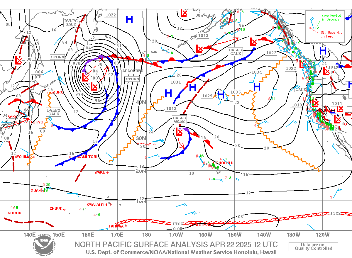
The climate status is officially La Nina this winter. Someone forgot to tell that to the jet stream. The El Nino-ish pattern has been fixed on the NPAC since late December to the near present, with its zonal, well-south-positioned jet stream, tracking fast-moving surface lows west to east moving within 1200 nm (and continuing to roll over and flood the US west coast– the commonly expected El Nino winter signature). The dry/light wind local weather is also a winter El Nino signature. This pattern has kept most days of surf in Hawaii at least near average and a few peak days to XL. But what has been missing in the NPAC pattern over the Hawaii swell window out to the WNW to N is the intensity of the surface lows. Most of the swells arriving have been from weaker systems (gales to severe gales) of moderate period energy (10-16s). One such feature, the last of a series (01/04-08) of lows crossing the Date Line, tracking east, and heading to dump more rain on Cali, is the source for our uptick in surf tomorrow 01/10. This source did have some upper-end gales north of 35N Saturday into Sunday, moving east of Hawaii late Sunday, aimed highest NE of Hawaii. It should turn the dominant swell direction locally from 320-330 degrees on Tuesday 01/10 with a bit more wave period (13-16s). This could bring surf to near average size.
That El Nino-ish pattern finally decided to turn up the stove on storm intensity to hurricane-force starting Sunday 01/08, with a second extreme system due to form on Tuesday 01/10. This will make for well above average, long-period (16-22s) events in Hawaii midweek into early next week.
The first one formed near 35N, 165E (2200 nm away) on Sunday 01/08. ASCAT validated a compact area of hurricane-force winds Sunday morning. The center moved east to near 40N on the Date Line (1700 nm away) early Monday 01/09 as the center dropped to 965 mb. Models show it dropping to near 960 mb as it passes N of Hawaii Tuesday. The system is shown to occlude (stall in motion, soon to weaken) on Wednesday near 45N, 140W (1600 nm NE of Hawaii). This long track from well NW to well NE of Hawaii will make for a wide local swell direction spread from 305-020 degrees, with a slow veering (clockwise) through the period (01/11-14).
The longest captured fetch (305-315 degrees) started out Sunday morning from well west of the Date Line 01/08 to near 900 nm away as middle gales, as model projected by 01/10. ASCAT satellite Sunday night showed hurricane-force winds have continued with the head of the fetch nosing over the Date Line within 305-315 degrees. JASON altimeter early 01/09 measured seas within 35-45 feet near the Date Line along this directional band. This captured fetch allows the dominant wave periods to grow into extra-long length (18-24s). These travel ~700 nm per day, so will be arriving locally just before dawn on Wednesday.
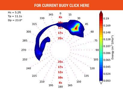
The Wave Watch III model (with GFS winds as input), show dominant swell direction 01/11 from 325-330 degrees. This is because the hurricane-force winds are expected to continue as the system tracks east from the Date Line along 40N, and the resultant seas from those winds will be generated closer (less loss of swell size during travel). But there should be closely equal energy from 305-330 degrees on 01/11. Heights are estimated to reach XL (high enough for outer reefs) just before dawn 01/11, and ramp up to giant levels (peak face top spots outer reef > 40’) midmorning 01/11. Heights should remain about the same into the evening.
Models show a front backed by N-component winds reaching Oahu overnight Tuesday and pushing south of Oahu by midday 01/11. This will make for crumbly lips, especially before noon, but the wobble factor should not be too bad since it is not expected to have enough wind magnitude or duration in the fetch NW to NE of Oahu for the wind swell hitting Wednesday from within 330-030 degrees (wind swell dominant wave period of 2-6s).
The 305-330 degree energy should still be XL on Thursday with a slow decline below average by mid Friday. The source is also expected to have substantial fetch of extreme strength over the 330-010 degree band as it pass to the N to NE of Hawaii Tuesday into Wednesday 01/10-11. This more N-component swell should be on the rise locally late Wednesday, peak on Thursday, then slowly drop below average Friday PM, with small to moderate surf from 350-020 degrees holding on for Saturday.


